On My Way Out
I used to consider GPS devices to be unnecessary and even annoying. I thought that they were antithetical to the very idea of an adventure. “Aren’t adventures supposed to be all about the unknown?” I would tell myself.
It wasn’t until I was kayaking with a friend that I began to see their importance and general usefulness. From fast-loading birdseye satellite imagery to a GPS built-in messaging system for communicating with rescue services.
It was obvious that there was a lot for me to learn. Some GPS devices can be recharged, while others require you to constantly purchase batteries in order to keep them powered on. There are several different kinds of GPS devices.
The best kayak GPS for you will have to cater to your needs. Every adventure is different, and so you’ll need a dynamic device such as the Bad Elf 2200 or the GPSMAP 66i to keep you on the right path.
Product
Details
Best Overall
Garmin GPSMAP 66i
- Map Type: Kinetic Topographical
- MOUNT: UNIQUE WRIST MOUNT
Best Dual Position Read
Garmin Foretrex 401 Waterproof
- Map Type: Kinetic Topographical
- Mount: Wrist expansion set
Best Outer Design
Garmin eTrex 10 Worldwide Handheld
- Map Type: Topographical
- Mount: Handheld GPS unit
Best Megapixel Camera
Garmin Montana 650
- Map Type: Street/Topographical
- Mount: Handheld GPS
Best Convenience Features
Garmin Instinct Solar
- Map Type: None available
- Mount: Wrist it
Best Premium Option
Lowrance Hook Reveal
- Map Type: Detailed visual maps
- Mount: Action-mounted GPS devices
Best Of The Rest
Bad Elf 2200 GPS Pro
- Map Type: None available
- Mount: Handheld GPS devices
Best for Communication

Garmin inReach Explorer+
- Map Type: topographical
- Mount: Handheld GPS devices
Kayak GPS Units: These Aren’t Fish Finders Are They?
Kayak GPS devices are powerful navigational tools designed specifically for kayakers. While they may share some similarities with fish finders, they serve different purposes.
A portable GPS device provides accurate positioning information, tracks your route, and helps you navigate safely on the water. It uses GPS satellites to determine your location, allowing you to mark waypoints, set up routes, and even track your speed and distance traveled.
Fish finders are designed specifically for anglers and focus on locating fish. A fish finder uses sonar technology to scan the water and display information about underwater structures, depth, and the presence of fish. Fish finder helps fishermen identify potential fishing spots, determine the depth at which fish are swimming, and improve their chances of a successful catch.
Unlike a fish finder that focuses on locating fish, the best kayak GPS devices prioritize navigation and safety. They provide essential information such as water depth, tides, currents, and potential hazards, allowing you to plan your trips effectively.
While fish finders can be a useful addition for anglers looking to find fish, GPS devices are more versatile and cater to the broader needs of kayakers.
Using a kayak GPS navigator offers numerous benefits. It enhances your situational awareness, ensuring you stay on course and avoid getting lost. It also helps you explore new areas and discover hidden gems without worrying about losing your way.
Additionally, in case of an emergency or rescue situation, the best kayak GPS unit can provide crucial information to aid in your rescue.
8 Best GPS For Kayaking
Below you’ll find that our listing was dominated by one company: Garmin. This isn’t as unlikely as it would seem. The world of snowboarding has Burton, and the kayak GPS units industry has Garmin.
However, just because these GPS systems all come from the same company does not mean that they are identical to one another.
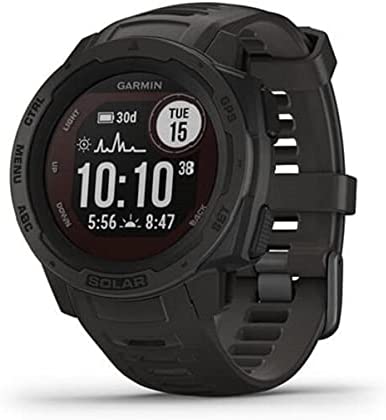
For example, my personal favorite, the Garmin Instinct Solar, is a kayaking GPS that you can wear on your wrist. True to its name, these GPS receivers can be charged using solar energy. This awesome and rare feature is not only incredibly useful but awfully convenient.
Although, it is worlds apart from the Garmin Foretrex. Despite also being a wearable unit, this wrist-mounted device features excellent waterproof protection. Think about your personal needs and have them guide you to the right choice below.
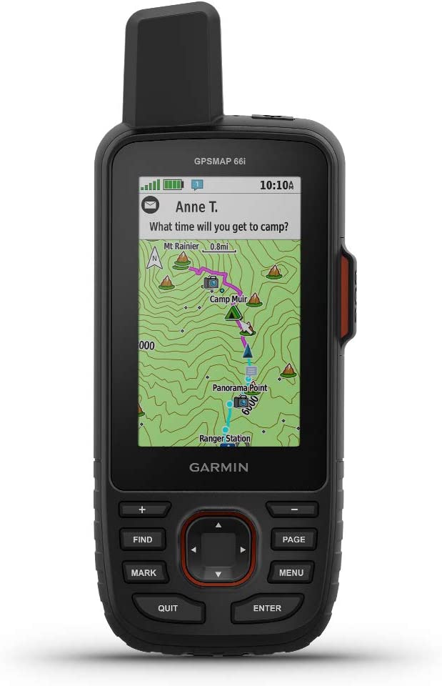
1. Garmin GPSMAP 66i
There’s a problem when it comes to picking out a lightweight GPS device to bring along on your paddling trip. You can choose a big screen but poor mobility or a tiny screen but great portability. None of these choices are optimal.
Fortunately, the Garmin 66i offers a new approach. It’s got the power to last throughout your journey and the accuracy to help you find your way.
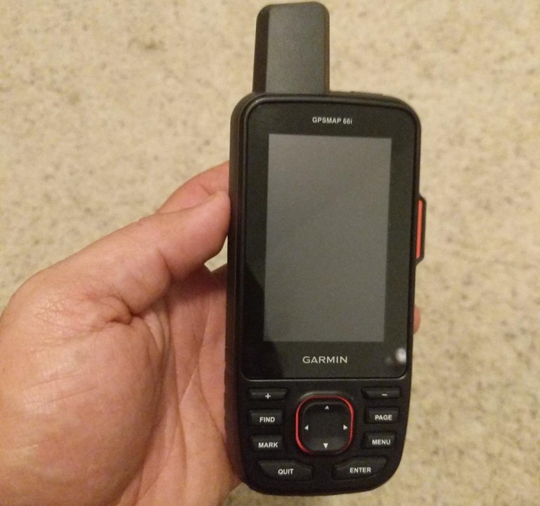
I mean, you’d have to be trying to get lost if you had fast-loading birdseye satellite imagery and still couldn’t find your way.
The best part about this GPS navigator is that despite not being a wristwatch, it does have a wrist mount. Easy access should you find yourself in a compromised situation. It also didn’t take me long to figure out how to activate the two-way messaging system.
Powerful yet intuitive!
Features
- Screen Size: Three inches
- Best Feature: Fast-loading birdseye satellite imagery
- Battery Life: Up to sixteen hours
- Map Type: Kinetic Topographical
- Mount: Unique wrist mount
Pros
- While the three-inch display may be small, it is sunlight readable.
- Comes with a two-way messaging system that can be used to contact rescue services.
- I found that the 16-hour battery life can be extended if used in different modes.
Cons
- Has unclear course correction when in areas of varied altitudes.

Garmin GPSMAP 66i
The Price of “Garmin GPSMAP 66i” varies, so check the latest price at
2. Garmin Foretrex 401 Waterproof
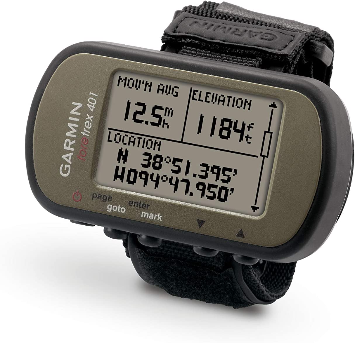
The Foretrex is a waterproof GPS device that takes no prisoners. I’ve come across many different waterproof GPS units in my time. Usually, these devices have a limit to how long they can remain submerged or wet. Unfortunately, these limits are easily surpassed.
The Foretrex isn’t like those devices. Not only can it last, but after having put it through some tests of my own, I found no issue with its performance.
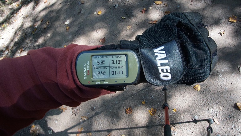
I suspect that this is because of the size of its screen. For any electronic device, the screen is the weakest point. Significantly reducing the display size definitely had an effect on its durability.
It took me a moment to understand how the dual position readout worked, but once I did, it was a feature that I could not live without.
Features
- Screen Size: Barely two inches
- Best Feature: Dual position readout
- Battery Life: Seventeen hours
- Map Type: Kinetic Topographical
- Mount: Wrist expansion set
Pros
- I enjoyed the pixel display, which has significantly upgraded visual fidelity.
- The comfortable strap worked well enough when securing onto my wrist.
- I liked the dual position readout, which allows me to view my current location in increasingly detailed ways.
Cons
- Uses AAA batteries to power itself. I found that to be tedious.

Garmin Foretrex 401 Waterproof
The Price of “ Garmin Foretrex 401 Waterproof” varies, so check the latest price at
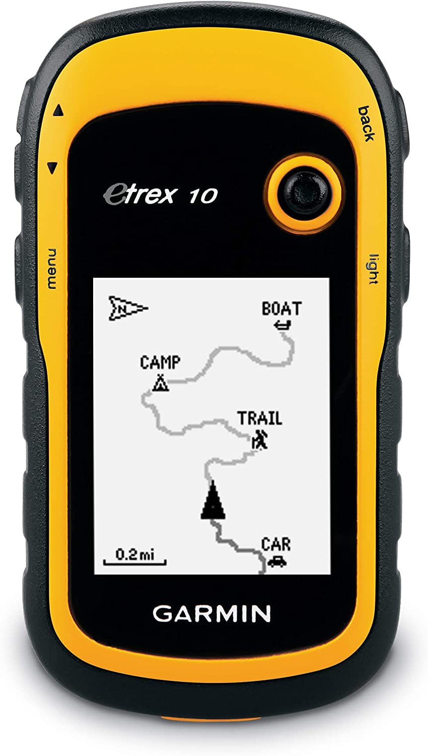
3. Garmin eTrex 10 Worldwide Handheld
The eTrex 10 also has a two-inch screen. Bringing with it all the durability and resistance that you would expect. However, one feature that sure caught me by surprise was the ability to see and chart all of the highest and lowest elevation points around me.
When I would kayak long ago, a feature like this would have been my most used. Sometimes you can’t tell what is beyond the river bank.
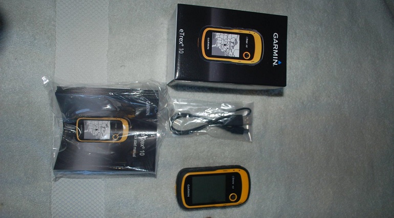
A device that clearly shows you significant changes in altitude gives you a richer view of the world around you.
I suppose that is why this GPS navigator was also given some waterproof capabilities. Hard to fully explore everything you see if your device shuts down at the first sign of water.
Features
- Screen Size: Two inches
- Best Feature: Paperless geocaching
- Battery Life: Twenty hours
- Map Type: Topographical
- Mount: Handheld GPS device
Pros
- Slightly “loud” aesthetic design that elicits contemptible moods.
- High-sensitivity GPS receiver design that has a waterproof rating that allows it to squeak by market standards.
- Unlike other devices, I enjoyed the ability to see high and low elevation points.
Cons
- The battery life of the Garmin eTrex is slightly lower than other models.

Garmin eTrex 10 Worldwide Handheld
The Price of “Garmin eTrex 10 Worldwide Handheld” varies, so check the latest price at
4. Garmin Montana 650
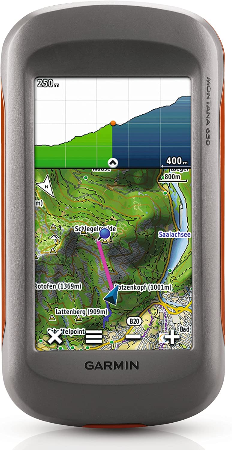
The Montana 650 came to play. Giving you more of what other devices have and new features that none of its competitors can offer. I’ll start off with its display size. Finally, a display that I don’t have to squint at to get a good reading.
Its four-inch screen allows you to get a better view of the street and topographic maps that the device offers.
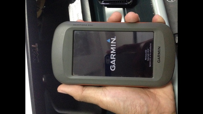
I always wondered, what was the point of giving us such highly detailed GPS maps if the screen wasn’t large enough to take advantage of them?
Montana 650 even comes fitted with a five MP camera. I know that doesn’t sound like much compared to the cameras in our phones, but for a GPS device, that’s impressive.
Features
- Screen Size: Four inches
- Best Feature: Five MP camera
- Battery Life: Sixteen hours
- Map Type: Street/Topographical
- Mount: Handheld GPS
Pros
- This GPS device has a large array of map types to choose from.
- Has a lengthy enough screen for easy viewing of the current location.
- You can browse the pictures that you take with this GPS device.
Cons
- I wish the three-axis compass had been more intuitive.

Garmin Montana 650
The Price of “Garmin Montana 650” varies, so check the latest price at
5. Garmin Instinct Solar
Here’s my personal favorite. I could go on and on about how cool the wrist-mounted Instinct Solar is. Is the screen size tiny? Yes, and that is an issue. However, one can’t let a single flaw drag down the awesome design of this GPS navigation device.
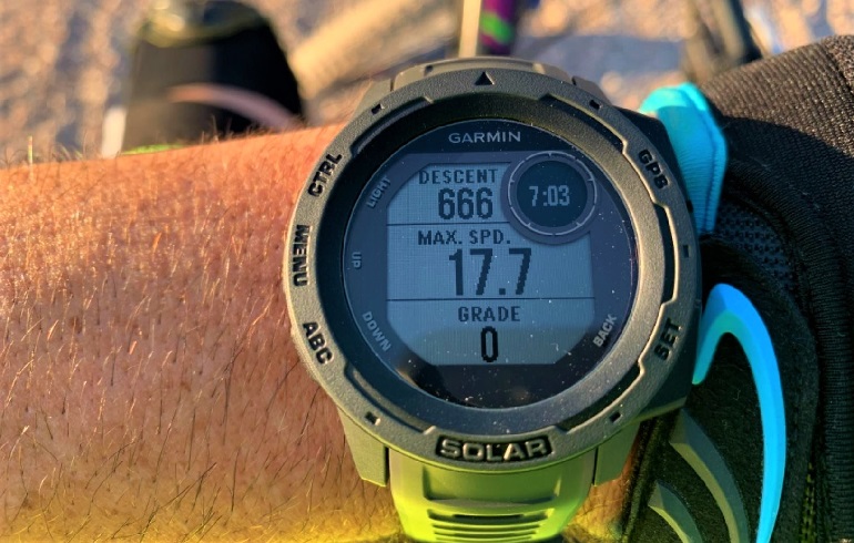
The instinct solar is used more as a tracking device for your own body’s vitals. Want to know how far you’ve come? Whether on a bike, on foot, or of course, on a kayak, this device will keep track of every inch of movement.
What’s more, you won’t have to worry about the battery dying on you. This watch is capable of being charged using solar energy. Following the same pattern as a solar beam, first, the energy is gathered, and then it is released when needed.
Features
- Screen Size: Barely an inch and a half
- Best Feature: Solar charging capabilities
- Battery Life: Extended
- Map Type: None available
- Mount: Wrist it
Pros
- The Garmin Instinct Solar is capable of being charged using bright sunlight.
- The solar charging capabilities that I mentioned above greatly extend the battery life of this watch.
- You can track how much you run, bike, swim, or travel with this watch.
Cons
- Unlike all other kayak GPS units, there was no way to view topo active maps using this device.

Garmin Instinct Solar
The Price of “Garmin Instinct Solar” varies, so check the latest price at
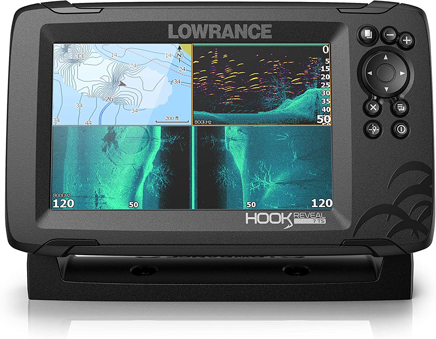
6. Lowrance Hook Reveal 7 with Tripleshot
Premium options are for those with a lot of money to spend. However, just because you are paying for something, doesn’t mean that it is “premium” or that it has more value than a free option. That is childish thinking. Foolish, I say!
No, the reason why the Lowrance Reveal 7 is ranked so highly isn’t because of its price. This device is quality because of the wealth of features that it offers you. From its awesome seven-inch display to the insanely detailed maps that can be downloaded.

I was also pleasantly surprised with its battery life. Long enough to last me several trips. This is even more astounding when you remember the visual fidelity of the screen itself.
I would consider this the best GPS device for kayaking by far.
Features
- Screen Size: Seven inches
- Best Feature: Highly detailed maps
- Battery Life: Enough for several trips
- Map Type: Detailed visual maps
- Mount: Action-mounted GPS device
Pros
- I loved the amount of detail that each map was presented with.
- By far, the best GPS for kayaking if you can afford the premium price tag.
- This GPS device even comes with CHIRP sonar technology for locating fish.
Cons
- If your kayak does not have any sturdy action mounting hardware, you’ll need to purchase it.

Lowrance Hook Reveal
The Price of “Lowrance Hook Reveal” varies, so check the latest price at
7. Bad Elf 2200 GPS Pro
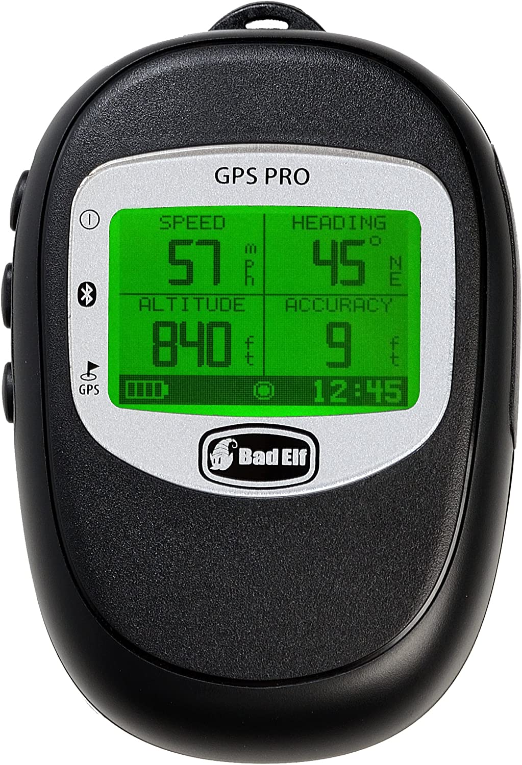
The Bad Elf is one great GPS device. At the top of its game when it comes to battery life and not slowing down for a second. The two-screen isn’t much of a drain, and although it is hard to work with at times, it was never impossible.
This device best operates as a tracker. You can use it to keep track of your speed as well as the current altitude and heading. I’d use the Bad Elf as a compliment to whatever true GPS device I already have in place.
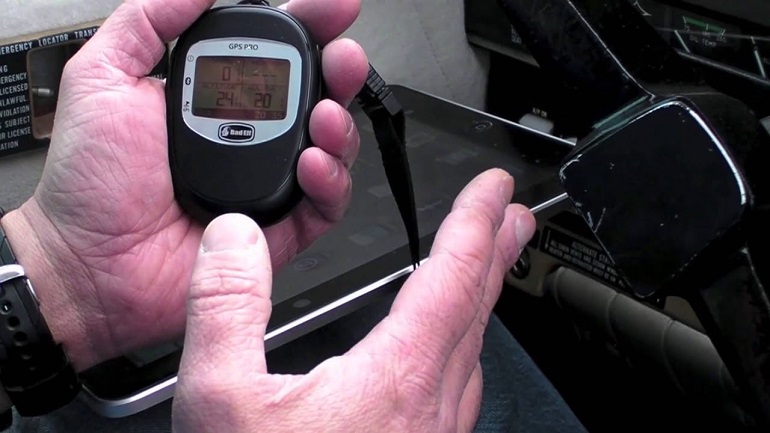
Knowing how fast your kayak is traveling is important because it gives you a rough idea of how long it would take to get to your destination. In case you want more detailed graphics, this device can connect to phones and tablets.
I had no trouble doing so, and the data was easier to read on a bigger screen.
Features
- Screen Size: Two inches
- Best Feature: Long battery life
- Battery Life: Thirty-five hours
- Map Type: None available
- Mount: Handheld GPS devices
Pros
- You can keep track of several different statistics when walking or running.
- I loved how easy it was to connect up to five different devices to this GPS device.
- The screen comes with a built-in backlight. This allows you to use the GPS device while in complete darkness.
Cons
- The lack of detailed maps or any maps of any kind was a bit of a letdown. However, not a serious issue for a GPS device.

Bad Elf 2200 GPS
The Price of “Bad Elf 2200 GPS Pro” varies, so check the latest price at
8. Garmin inReach Explorer+
The game-changing feature of the Garmin InReach Explorer is its ability to send and receive text messages with cell phones worldwide, setting it apart from other devices with decent additional functions.
The sturdy body of this rugged handheld GPS navigator plus communication device is built to withstand tough conditions with an IPX7 waterproof rating. While slightly heavier than the average GPS, this device feels lightweight, considering its additional satellite communication capabilities alongside standard navigation functions.
According to Garmin, inReach can operate for up to 100 hours without any issues, even when continuously sending tracking waypoints every 10 minutes. It means you won’t have to worry about its battery life while trekking into the unknown.

What’s more? You can plan your routes and save waypoints in advance, ensuring you stay on track with the integrated digital map and electronic compass for a seamless navigation experience.
Features
- Screen Size: Two and three-tenths inches
- Best Feature: Two-way text messaging
- Battery Life: Hundred hours
- Map Type: Topographical
- Mount: Handheld GPS navigator
Pros
- All-in-one solution: weather reports, GPS, tracking, SOS, and no need for a smartphone connection to access features.
- It has long battery life, an intuitive user interface, and a wide operating temperature range for optimal performance.
Cons
- One of its weaknesses is its size, as many newer models with similar capabilities are much lighter and smaller in construction.
- A paid subscription is required for utilizing the Garmin InReach services.

Garmin inReach Explorer+
The price of “Garmin inReach Explorer+” varies, so check the latest price at
What To Know About the Best Kayak GPS Devices
Earlier, I told you to think about your specific needs before making a choice. However, what if it is true that you still don’t know which option should be your dedicated GPS device? Worry not, the best kayaking GPS gadgets are complex and vary a lot.
This is why I have broken down everything you need to know, as well as everything I know, about most GPS systems. A lengthy omnibus, like the one presented to you down below, is sure to help you better understand just what it is you are purchasing.
The most wondrous kayaking GPS units from the best kayak brands should have a majority of the features listed below. At the very least, those gents should be able to perform consistently, no matter the terrain you may find yourself in. There’s much to wend over; let’s go over them:
GPS Devices and Their Designs
The design of GPS systems directly affects everything else about those folks. Think of this as the outer blueprint that will determine how much space can be used for the display. Other important design features include the weight and feel of the GPS gadget.
You don’t want a unit that slips out of your hand or, worst yet, can’t be mounted anywhere on your wrist or body.
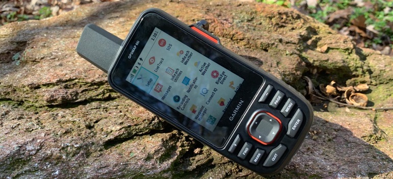
I would advise you to use a device that you feel comfortable working with for extended periods of time.
Waterproof GPS Devices
I have gone over plenty of GPS gadgets that are waterproof. However, being waterproof is not a universally applied concept. Different GPS units have different levels of waterproofing.
Of course, it is better to have some waterproof protection than no protection at all, but knowing the limits of your device’s waterproof protection is vitally important. A great way to tell at a glance whether or not your device is made for kayaking is its waterproof rating.
The higher the rating, the better. I believe this is the case because each rating level brings with it a suite of new protections.
Display Size and Readability
Yeah, there aren’t too many winners listed above as far as display sizes go. Most GPS devices on our list have a screen size that hovers around two inches. Is two inches enough? Depends on who you ask.
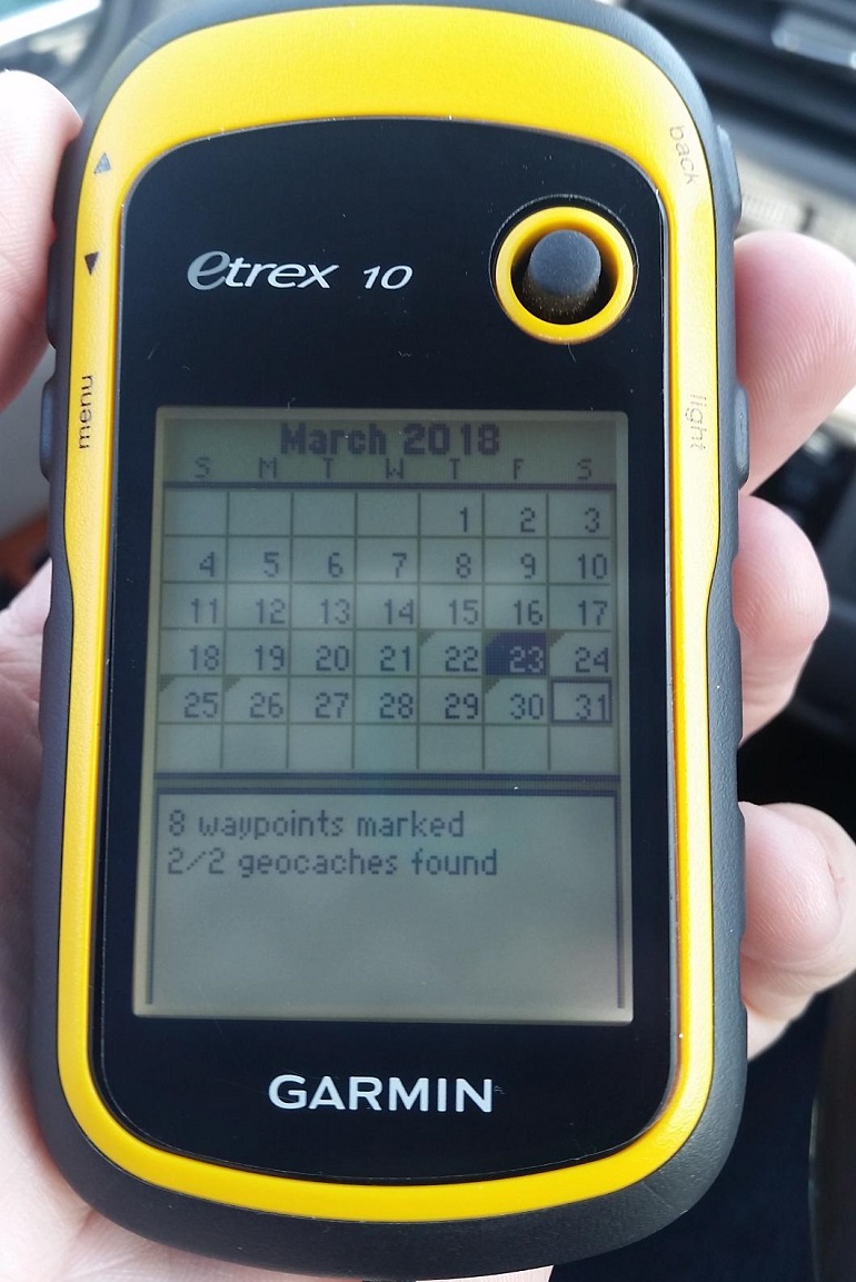
Some may be satisfied with that length. It is possible that they are seeing enough information to use their GPS device to the best of their ability. However, older kayakers and those with poor eyesight, of which there are many, will need something bigger.
There are dedicated GPS devices with much larger screens, but they are as fragile as they are big. Each sizing option has its downsides and upsides.
Birdseye Satellite Imagery
Now that is one futuristic-sounding feature. Birdseye imagery is the cream of the crop when it comes to maps and imagery provided by a GPS device. It doesn’t get better than this, and one look at it will show you why.
This kind of imagery provides you with a true representation of your surroundings. Fit with all the geographical details that you can imagine. Planning a kayaking excursion will be no problem at all with this beast.
Birdseye imagery also gives some colorful and high-resolution maps. Any accurate GPS unit with a Birdseye satellite imagery subscription is a must-buy.
GPS Units and Battery Life
Changes in atmospheric pressure can cause the sunlight-readable color display to drain the GPS’s lithium-ion batteries faster. It affects the battery life.
The manufacturer can provide you with a baseline number, but there is no way of telling how it will hold up in more extreme scenarios. A GPS device with an external battery and rugged construction wouldn’t fail you if the right conditions are provided.
Fortunately, the GPS technology gadgets listed above have all been put through rigorous quality tests by their manufacturer. Just to be safe, I recommend bringing along an extra pair of batteries.
The Internal Memory of a GPS System
Before I get into this topic, scroll up to whichever lucky GPS device you will be purchasing. Check its page. Does it come with a micro SD card slot? If not, then you will need to find out how much internal memory your GPS and GLONASS systems have.
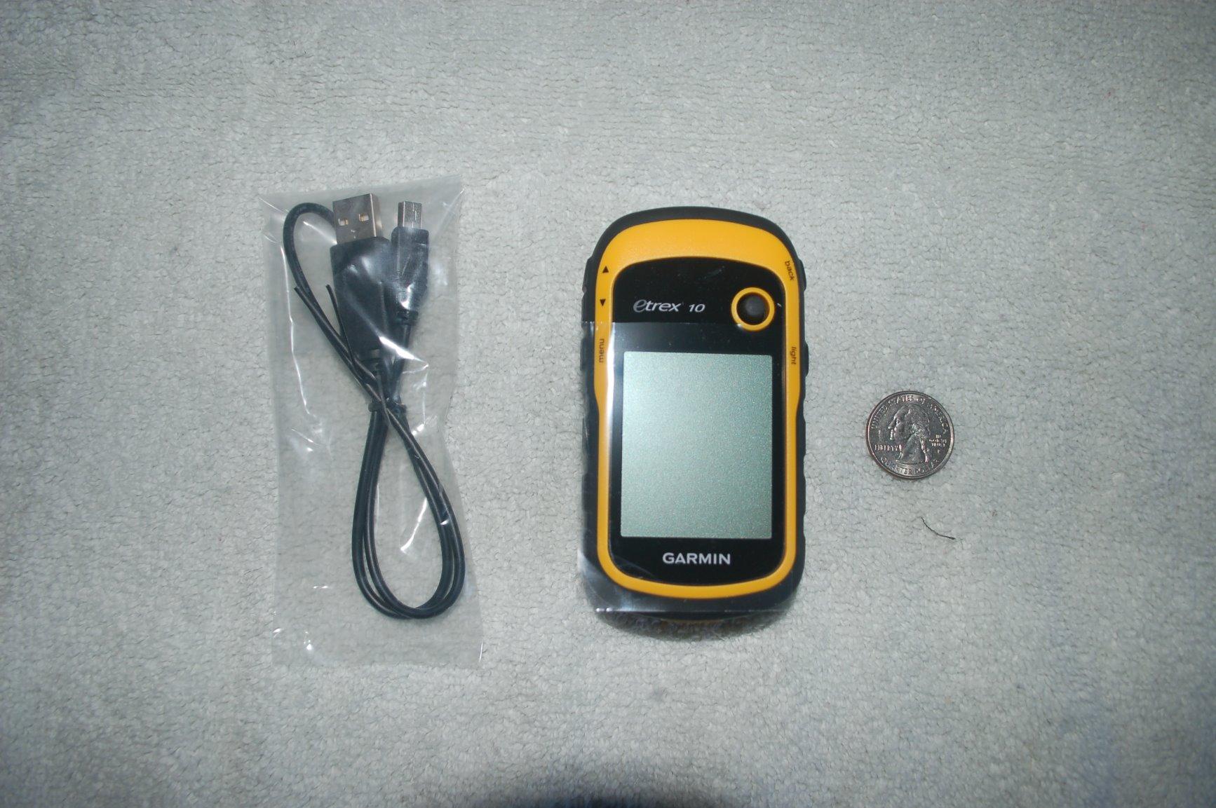
The amount of internal memory that you need for your adventures is determined by how many maps you’ll be downloading. I would strongly recommend that you get a device that allows you to stick in an SD card.
With an SD card slot, you won’t have to worry about any memory issues at all. Clearing the memory is also a whole lot faster and easier. This is because an SD card can be removed and then wiped using a laptop or personal computer.
Something to keep in mind is that not all the best GPS devices allow you to download or store maps and topographical data. If this is the case, then obviously, internal memory becomes less of an issue.
Range Of Coverage
At the beginning of the journey, you want a specific location and need to determine your starting point. But what about everything else in between?
The coverage range of a GPS device is the range to which the device can accurately map out your surroundings, also locating when you are out in deep waters. Many GPS devices come with marine maps and other additional maps that you haven’t covered.
Most GPS manufacturers understand the importance of having a valorous coverage range. With a majority of GPS devices, you can reliably count on accurate results up to ten meters in all directions.
Detailed Mapping
I ask myself, what’s the point of a GPS system that doesn’t provide you with highly detailed maps?
While the most detailed maps aren’t needed at all times, some of us would just rather have a starting and ending point, it definitely doesn’t hurt to have as much information as possible.
But what information can be put into a map? Yes, we all know about the major terrain changes and landmarks, but is there anything else? I’m pleased to say yes. Other game-changing bits of information include altitude and volumetric data.
You can receive weather reports and updates; that’s even better!
Device Size and Portability
I’ve already spoken about this briefly in the GPS design section. However, now I shall be going over this in length. The size of your GPS device is very important because it directly corresponds to how you shall be using it on your kayaking adventures.
For example, a handheld GPS is small enough to store anywhere. However, because it is not wrist-mounted, it will be much harder to use on the fly. I personally would rather have a GPS device that is able to attach to my own wrist.
There are also GPS units that have a very low portability score. I would count the Lowrance Hook Reveal 7 amongst those folk. Its large display has benefits and downsides to it.
Additional Features
It seems that I’ve run through the gambit of features and design specifications that a GPS device can have. What could possibly be missing from a GPS device that hasn’t already been discussed?
Well, how about I start off with a camera? The Garmin Montana 650 has a five-megapixel camera that you can use to take snapshots of your favorite moments. One complimentary feature that comes along with it is the SD card slot.
If the internal memory isn’t enough for you, then this slot is a most wondrous way to expand your storage space on the fly.
Kayak GPS FAQs
Here, we’ll answer common questions regarding GPS units; let’s dive in:
Why Do Kayak GPS Systems Have Such Small Screens?
There’s no need to judge! The reason why kayaking GPS devices have such tiny screens is that much of their build and structure is dedicated to the technical parts that allow these devices to do what those tools are supposed to do in the first place.
Screen size is also often kept to a minimum because most GPS devices need to be portable. This is why they often employ handheld designs. Many GPS devices can even be worn on your wrist!
How Accurate Is a Handheld GPS?
How accurate a GPS device is, is entirely dependent on the range of its map. For example, the further you are zoomed out from your current location, the less likely the results are to be accurate.
However, many modern kayak GPS devices are capable of giving you an accurate read, regardless of how far you search. There are devices that have a micro sd card slot along with internal memory. An SD card allows you to store your downloaded maps. Letting you access more accurate versions without any need for a solid connection.
How Do I Mount My GPS to the Kayak?
You are going to need an action mount. Many kayaks come with this feature built-in. I’ve also encountered several kayaks that come with a dashboard. Of course, with a dual battery system, any Bluetooth-compatible devices can be mounted onto the dashboard.
If your kayak doesn’t have any of these features, worry not! With the help of some trusty D-rings (Sonic rings), you can install the needed parts yourself.
My Final Thoughts
A kayak GPS device should always get the basics down perfectly. What do you need? To be able to access accurate topographic maps in high detail. What do I need? To be able to not get lost even when I have a WAAS-enabled GPS receiver with me.
Try not to get hung up on extra features and plaited add-ons. First, you’ll need to be able to see the land around you, and then you can worry about cameras and all the other extra bells and whistles.
My personal pick would be either the Garmin Etrex or the Garmin Instinct Solar. Both kayak GPS systems have the features and accuracy I need to head out and discover lands anew. However, your choices may be different.
Remember, once you are sure that you’ve got a quality selection of GPS devices, like the list above, then you can be safe to consider what extra features would benefit you the most.
So whether you’re in your reliable duck-hunting kayak or zooming ahead on your high-speed motorized kayak, now you can navigate uncharted waters and discover new horizons with confidence by harnessing the power of your GPS!
0 Comments